These 20 stunning pictures from space show the beauty, power, and fragility of our water systems
THE NILE RIVER, EGYPT
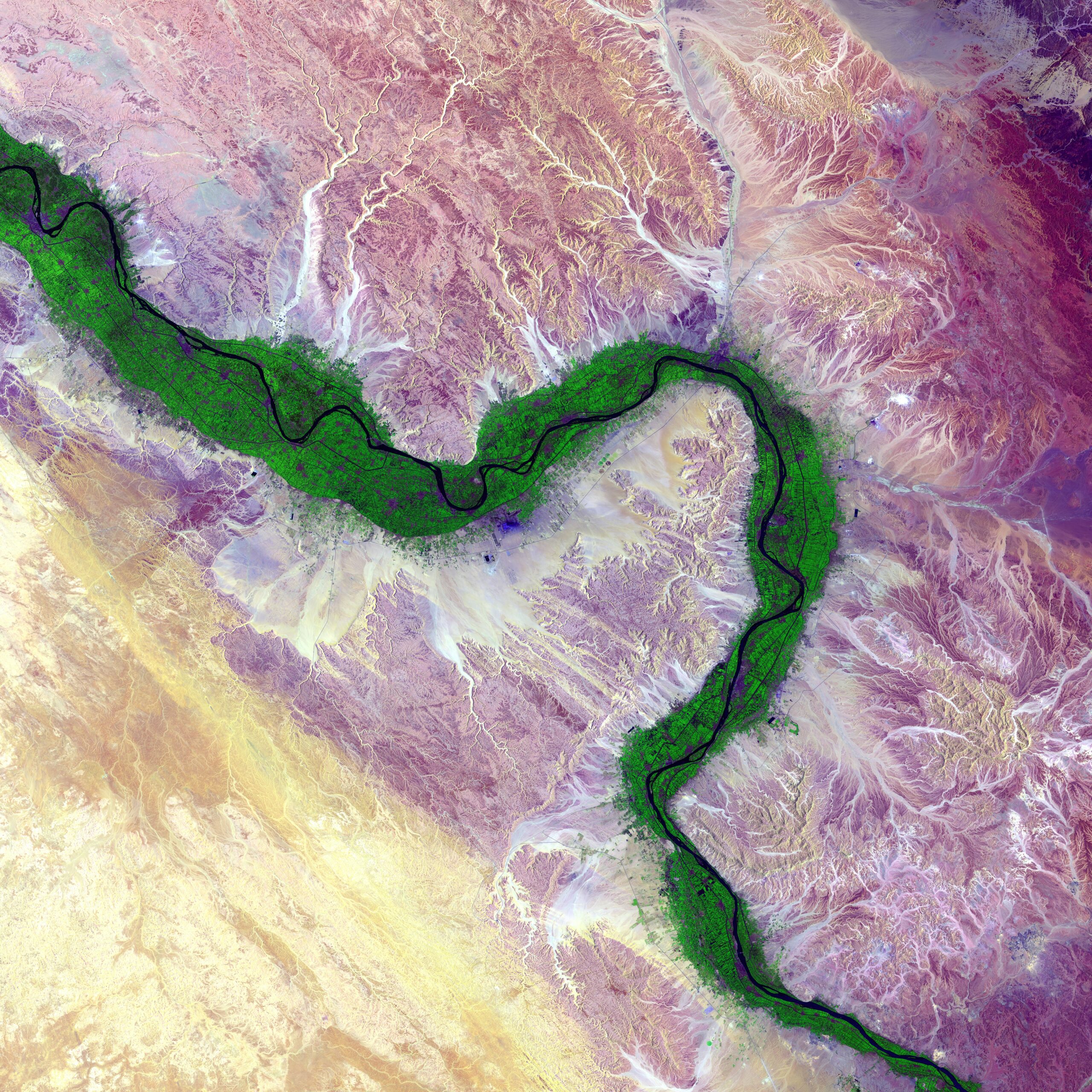
It is easy to see from this image why people have been drawn to the Nile River in Egypt for thousands of years. Green farmland marks a distinct boundary between the Nile floodplain and the surrounding harsh desert. (© USGS)
Throughout the twenty-first century, climate change is predicted to increase the standard deviation of the Nile’s flow by approximately 50%, indicating a doubled likelihood of both flooding and drought. Not only does this threaten the livelihood of individual families; it also stands to impact the $28 billion agricultural sector of Egypt’s economy.
THE MISSISSIPPI RIVER, USA
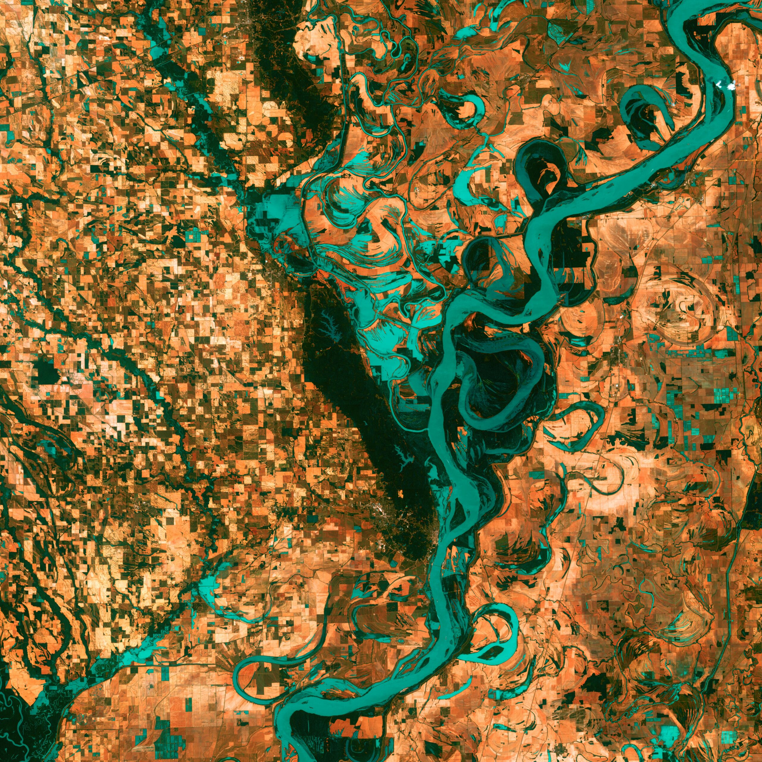
Small, blocky shapes of towns, fields, and pastures surround the graceful swirls and whorls of the Mississippi River. Countless oxbow lakes and cutoffs accompany the meandering river south of Memphis, Tennessee, on the border between Arkansas and Mississippi, USA. (© USGS)
In the Spring of 2019, severe flooding in the Mississippi River Basin inflicted billions of dollars in damages to farmers, agribusinesses, and meat companies. Millions of acres of corn, wheat, and soy couldn’t be planted and $1 billion of grain couldn’t be shipped from major ports, such as those in southern Louisiana, because of flooding.
KHOR KALMAT LAGOON, PAKISTAN
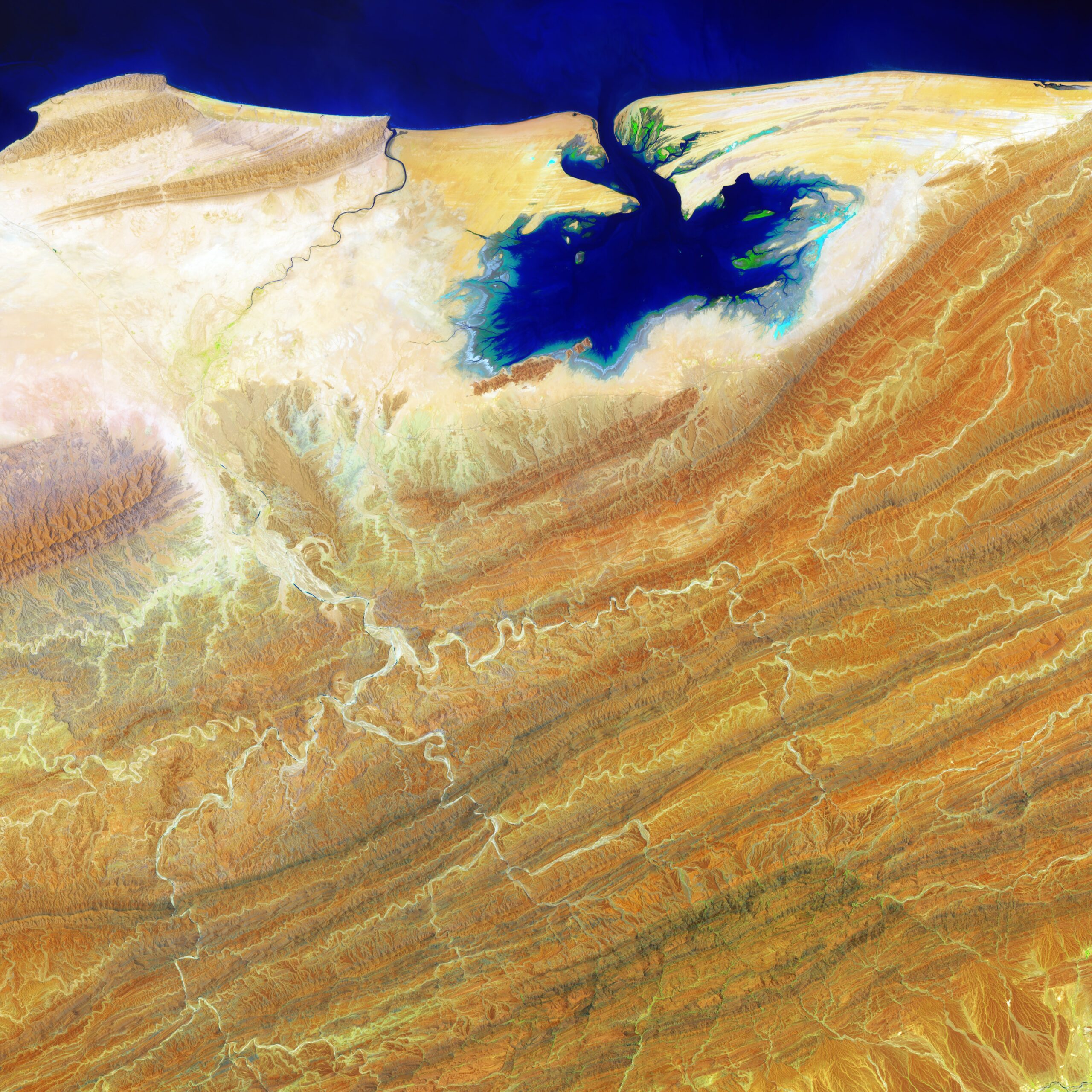
Like blue ink bleeding onto parchment, the Khor Kalmat lagoon branches off the Arabian Sea and spills into the southern Pakistan landscape near the Makran Coast Range. Mudflats cover almost the entire lagoon, which fills with shallow water at high tides. The small areas of green are isolated pockets of mangrove forest. (© USGS)
Mangroves are among our best allies against the impacts of climate change. Initiatives are underway to protect and restore these ecosystems, which benefit local communities, host rich biodiversity and help build resilience against extreme weather events.
PANTANOS DE CENTLA, MEXICO
Much of this image consists of the Reserva de la Biosfera Pantanos de Centla, a biosphere reserve in southern Mexico that protects wetlands in the area. The water bodies, mangroves, and forests are a sanctuary for a great variety of wildlife. Sediment carried away by the Grijalva River appears as a sweeping light blue brushstroke flowing into the Gulf of Mexico at the top of the image. (© USGS)
Hydrologically, the reserve is among the most important sites of its kind in Mesoamerica, influencing the ecology from southern Mexico to northern Guatemala. The site consists of 110 (permanent and temporary) freshwater bodies important for fishing and flood regulation.
COASTAL DELTAS, THE NETHERLANDS
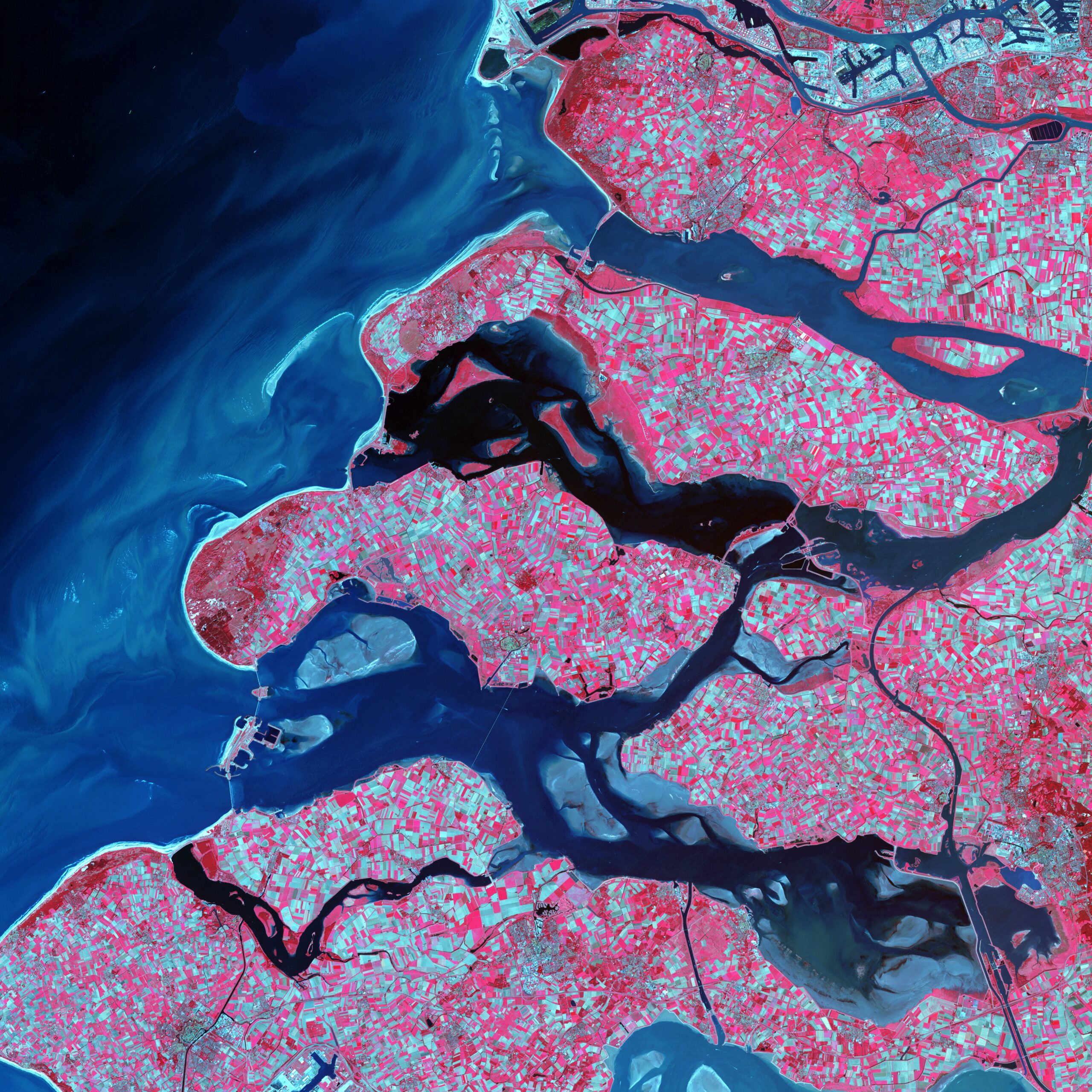
Along the southern coast of the Netherlands, sediment-laden rivers have created a massive delta of islands and waterways in the gaps between coastal dunes. After unusually severe spring tides devastated this region in 1953, the Dutch built an elaborate system of dikes, canals, dams, bridges, and locks to hold back the North Sea. (© USGS)
More recently, the Netherlands has developed the concept of “room for the rivers”, which focuses on a holistic approach to water management, rather than one based on controlling or ‘fighting’ against water.
THE TIETE RIVER, BRAZIL
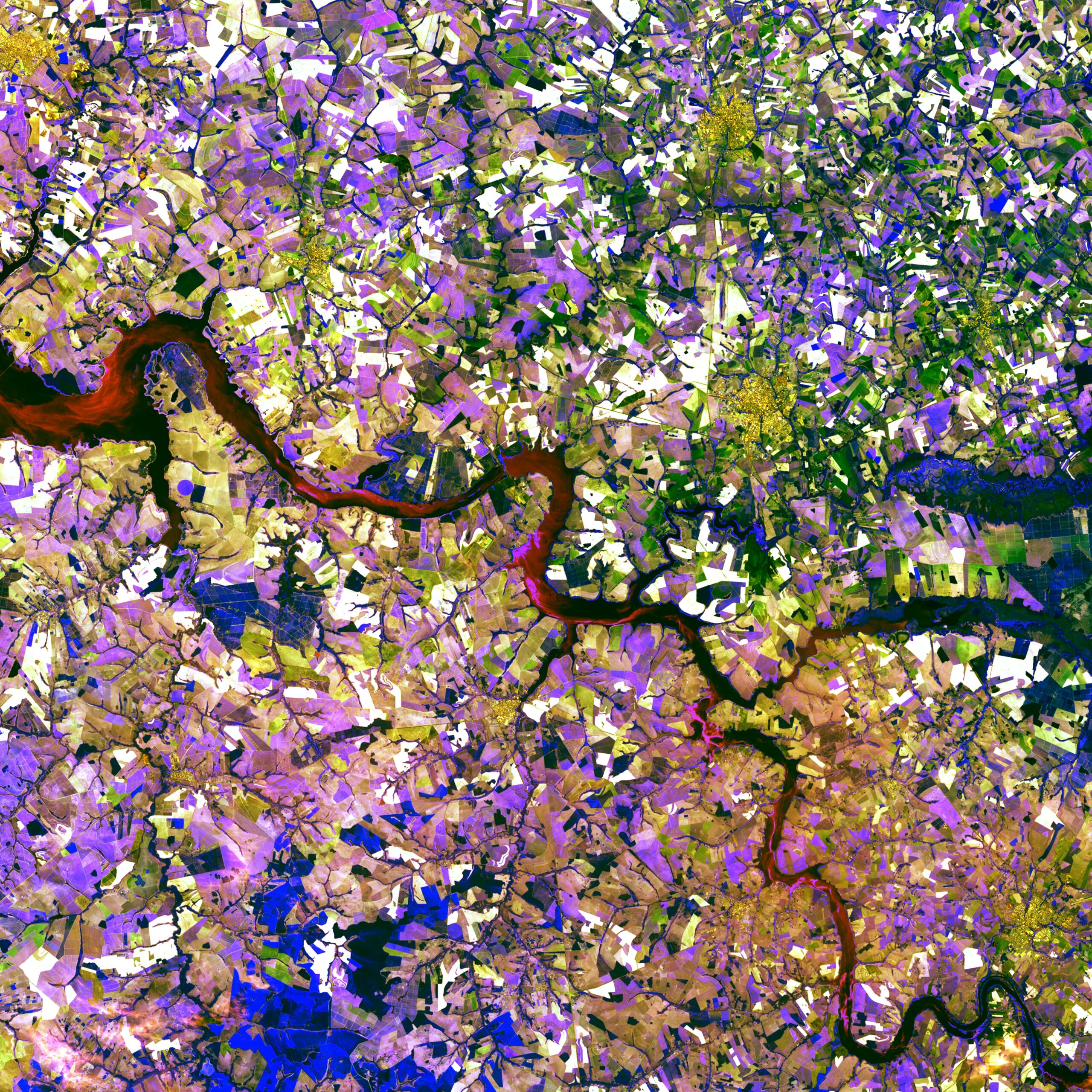
The Tietê River snakes across this tessera mosaic of multicolored shapes near Ibitinga, Brazil. Fields of sugarcane, peanuts, and corn vary in their stages of development. Lavender, purple, and bright blue indicate actively growing crops. Light yellow or white indicate little or no vegetation growth. The splotches of dark mustard yellow are urban areas. (© USGS)
In the second half of the 20th century, rapid population growth, inadequate wastewater treatment, and solid waste contamination meant the Upper Tietê River was one of the most polluted watercourses in Brazil. An extensive restoration programme has brought together government, utility companies, and civil society to restore this meandering lifeline.
THE OKAVANGO DELTA, BOTSWANA
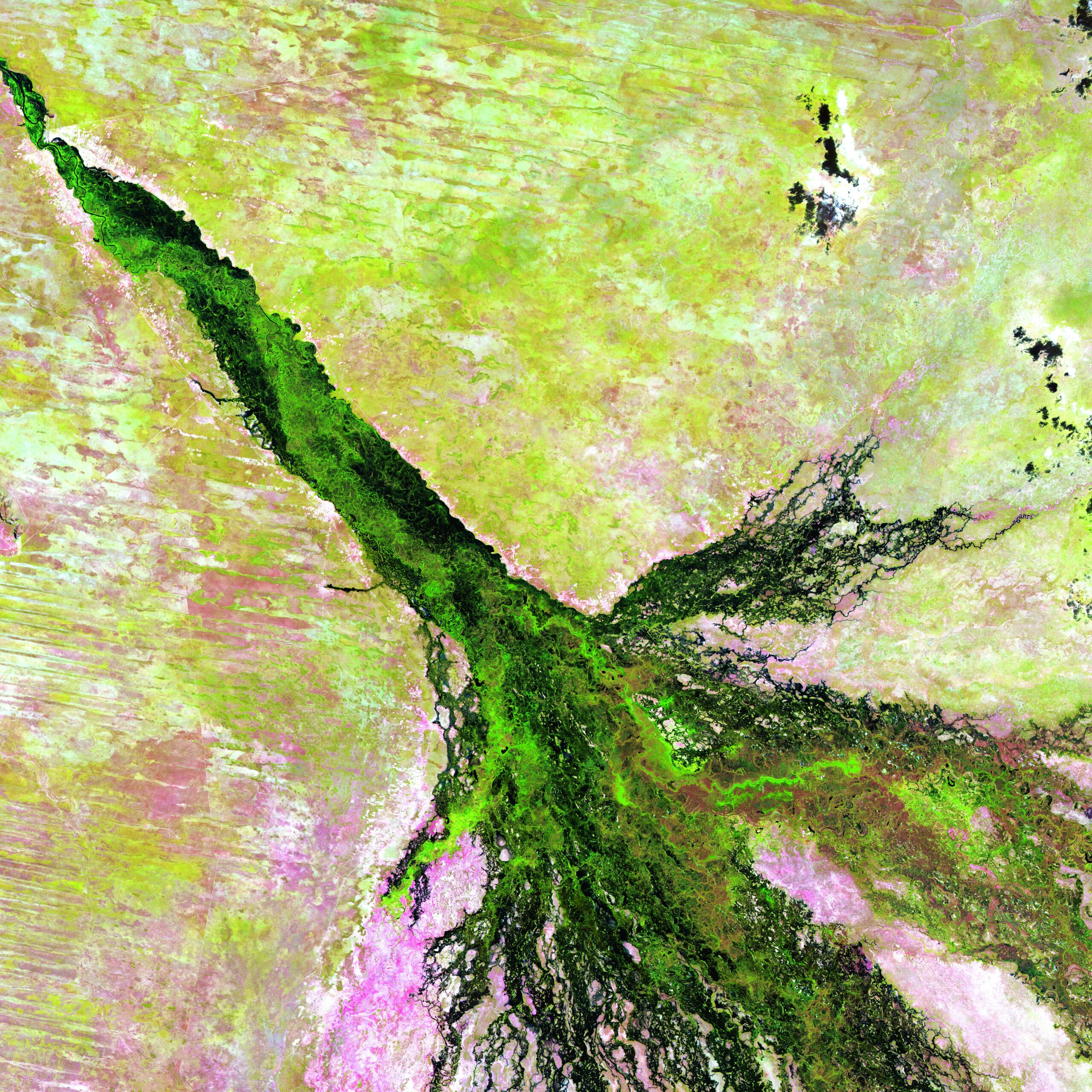
Like a watercolor in which a brushstroke of dark green has bled into a damp spot on the paper, southern Africa’s Okavango River spreads across the pale, parched landscape of northern Botswana to become the lush Okavango Delta. The delta forms where the river empties into a basin in the Kalahari Desert, creating a maze of lagoons, channels, and islands where vegetation flourishes, even in the dry season, and wildlife abounds. (© USGS)
The Okavango Delta is also host to one of four pilot efforts across Africa trying to integrate information about freshwater biodiversity into the development planning process. The Okavango Delta in Botswana is a site of global importance for biological conservation and diversity. It forms one of the world’s largest Wetlands of International Importance, as designated under the Ramsar Convention on Wetlands.
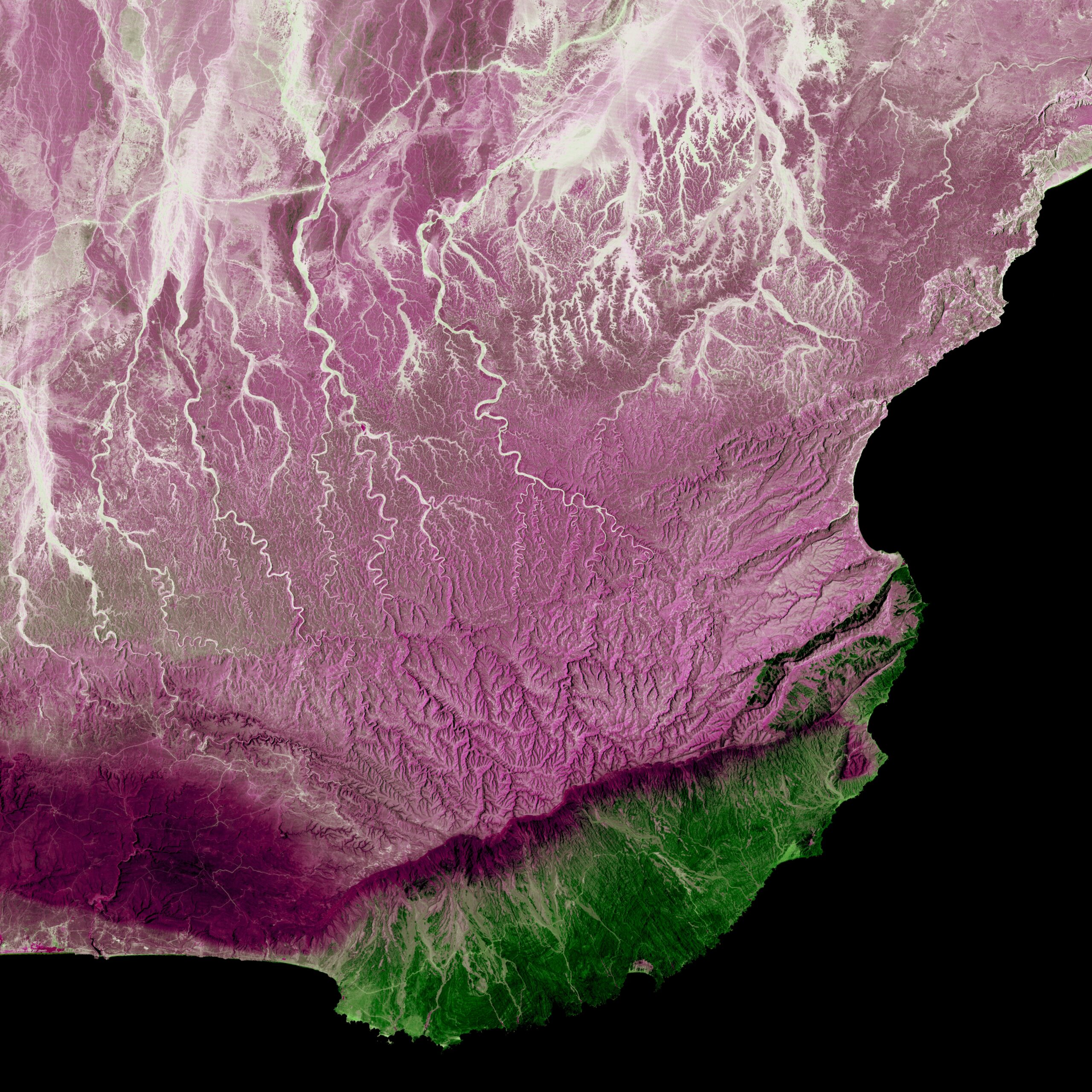
THE META RIVER, COLOMBIA & VENEZUELA
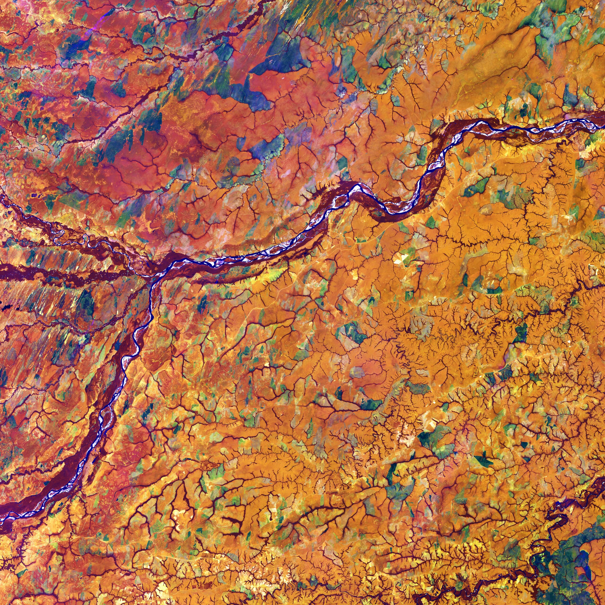
Marking part of the boundary between Colombia and Venezuela, the Meta River resembles an artery among capillaries within the human body. Those capillary-like features actually depict dense tree cover along the numerous streams that flow among rich tropical grassland. (© USGS)
Dolphins living in the Meta River have been identified as key ‘sentinel species’ which can help scientists to assess and address the impacts of climate change on this watershed.
THE SIRHAN BASIN, JORDAN
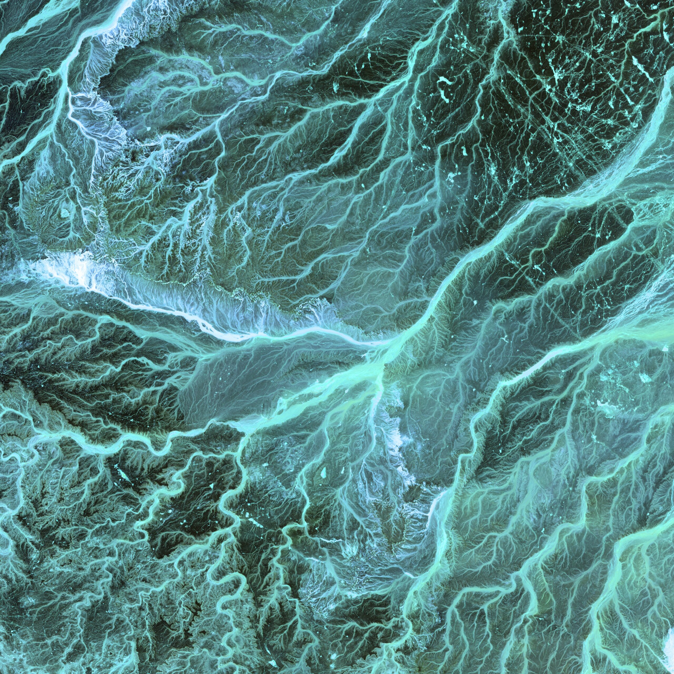
Meandering wadis combine to form dense, branching networks across the stark, arid landscape of southeastern Jordan. The Arabic word “wadi” means a gully or streambed that typically remains dry except after drenching, seasonal rains. (© USGS)
Mean annual rainfall in the Sirhan basin is just 40-50mm.
THE BENI RIVER, BOLIVIA
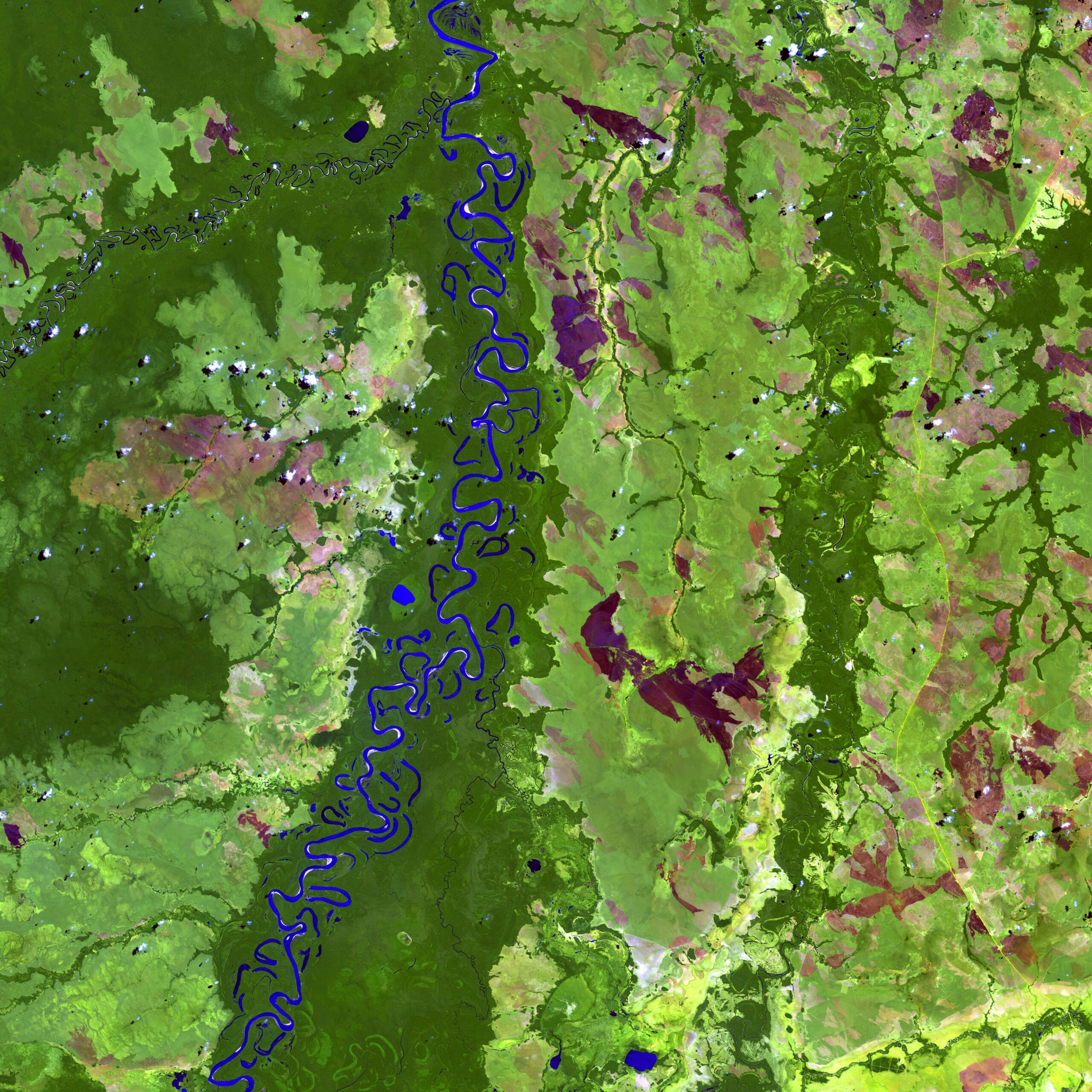
The Beni River in Bolivia resembles a blue ribbon as it meanders toward the Amazon River. Scattered along the river are numerous oxbow lakes, which are curved bodies of water that form when a meander from the main stem of a river is cut off, creating a freestanding body of water.
Dark green colors in the image indicate forest and lighter green shades indicate grassland or sparse forest. (© USGS)
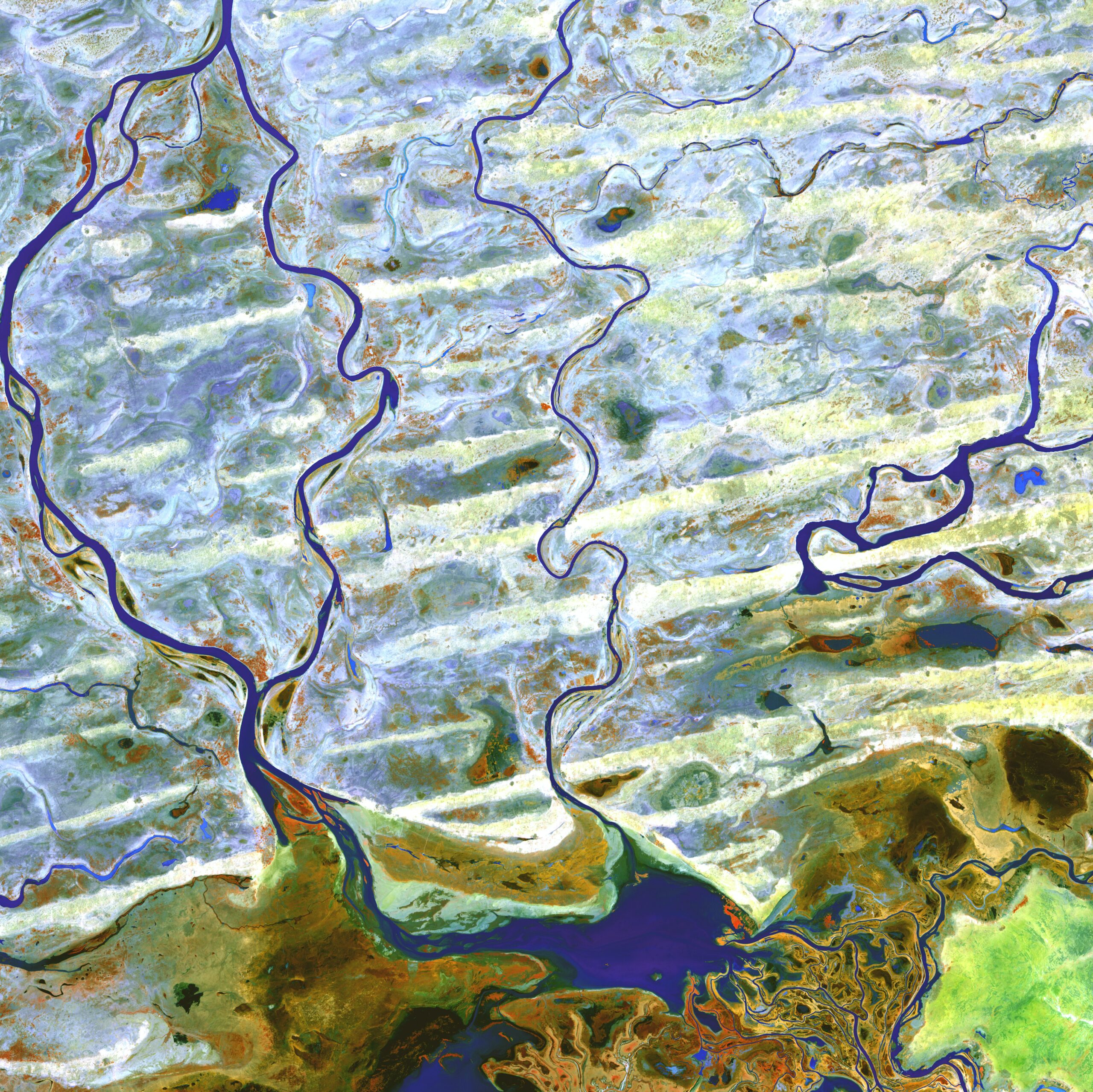
XINJIANG PROVINCE, CHINA
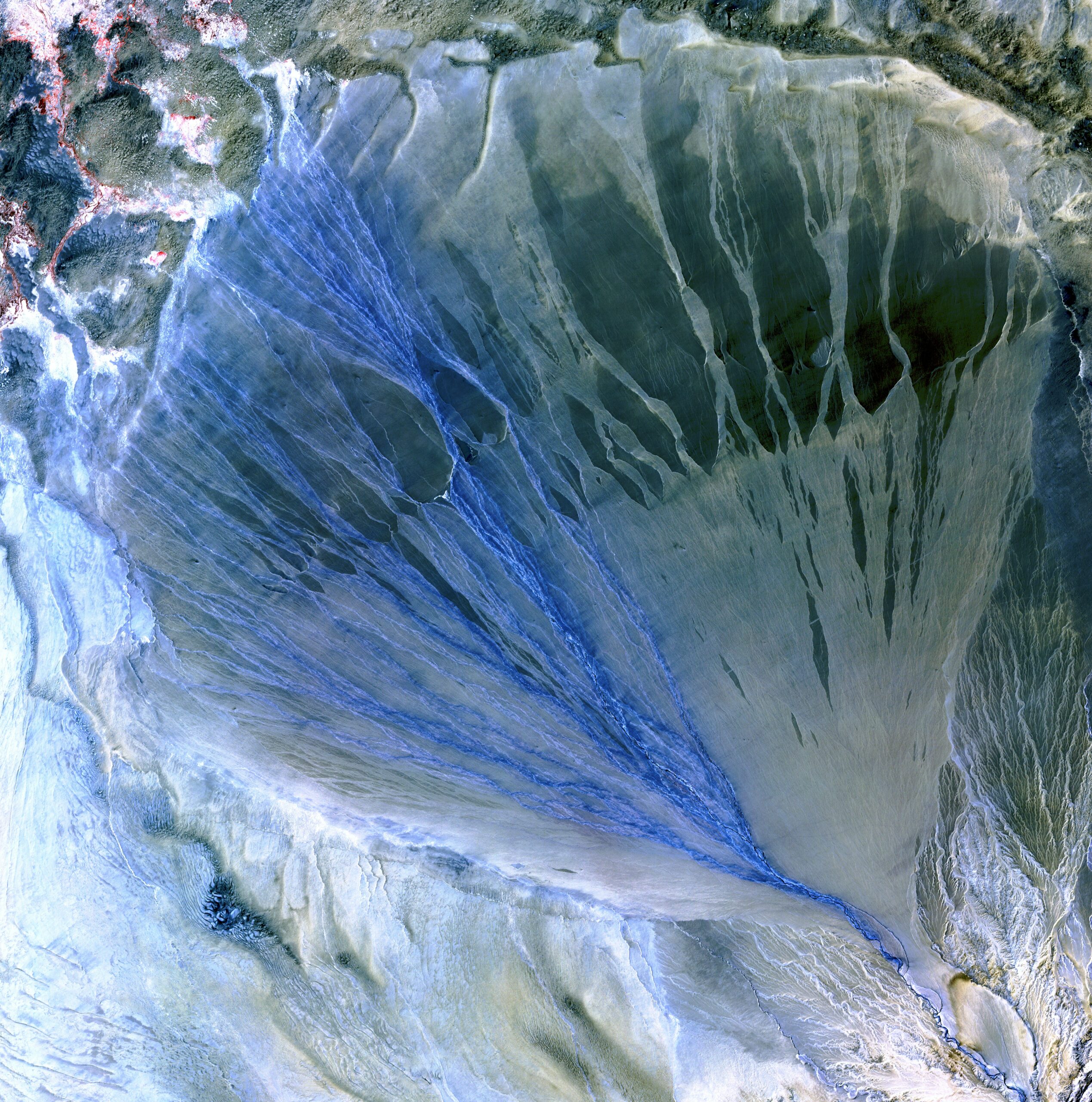
A vast alluvial fan blossoms across the desolate landscape between the Kunlun and Altun mountain ranges that form the southern border of the Taklimakan Desert in China’s XinJiang Province. (© USGS)
The desert formed at least 5.3 million years ago and covers an area close to 340,000km2. – almost as large as Germany. It is the largest desert in China – the second largest shifting desert in the world – and so treacherous that the silk road split into two branches to avoid traversing it.
CANYONLANDS NATIONAL PARK, USA
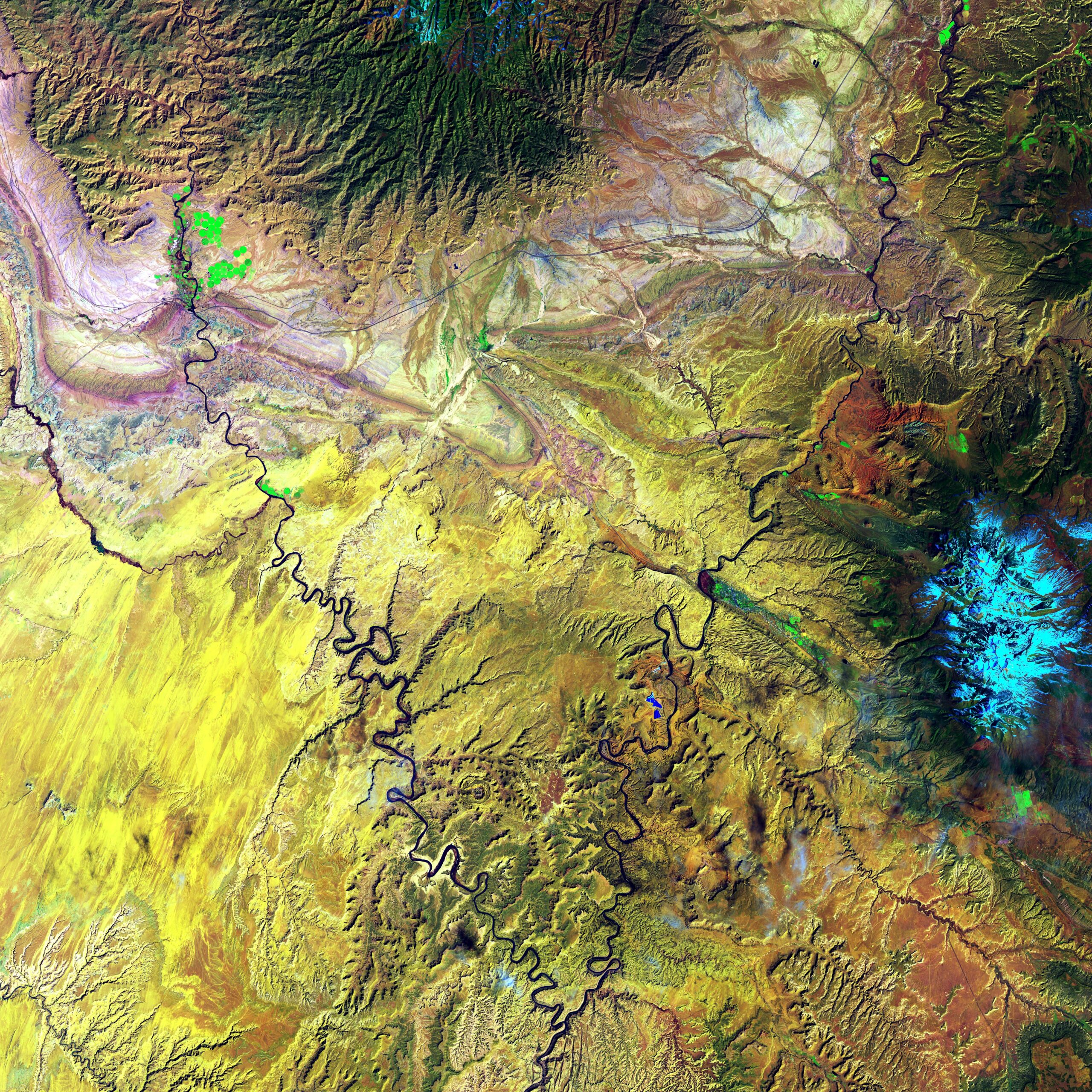
The Green River and the Colorado River meet within Canyonlands National Park in Utah. Snow-covered Mount Waas, shown in light blue on the right side of the image, overlooks the arches, canyons, and bizarre rock formations that prevail throughout this region. (© USGS)
In 2021, downstream from here, the US federal government declared a water shortage on the Colorado River for the first time, triggering mandatory water consumption cuts for states in the Southwest, as climate change-fueled drought pushes the level in Lake Mead to unprecedented lows.
DHOFAR, OMAN
Much of Oman is desert, but the Arabian Sea coast in the Dhofar region represents a startling difference in climate. This coastal region catches the monsoon rains, or khareef, during the summer months.
Drenching rains fall primarily on the mountainous ridge that separates the lush, fertile areas along the coast from the arid interior, recharging streams, waterfalls, and springs that provide plentiful water supplies in the fertile lowlands for the remainder of the year. (© USGS)
SHOEMAKER IMPACT SITE, AUSTRALIA
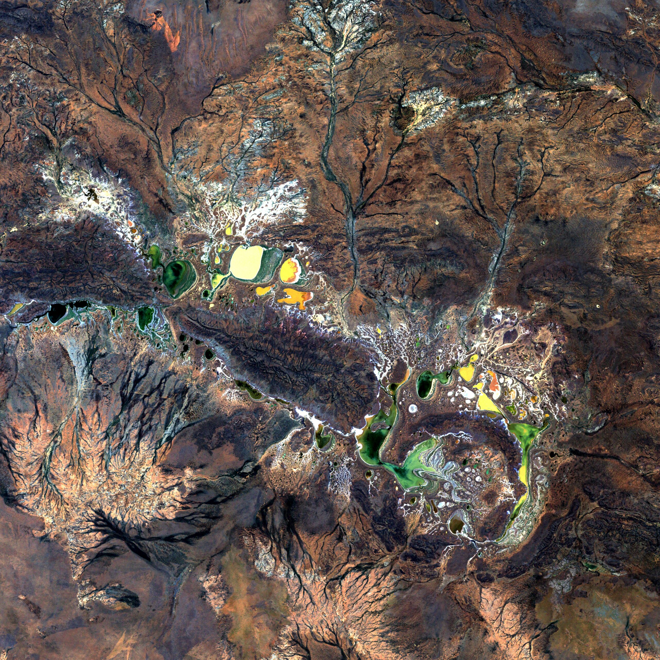
Resembling splotches of yellow and green paint, salt-encrusted seasonal lakes dot the floor of Western Australia’s Shoemaker impact structure. The structure is currently the oldest known impact site in Australia. (© USGS)
The crater is thought to have been formed 1.63 billion years ago. Several saline and ephemeral lakes—Nabberu, Teague, Shoemaker, and numerous smaller ponds—occupy the land surface between the ring structures.
THE YUKON DELTA, USA
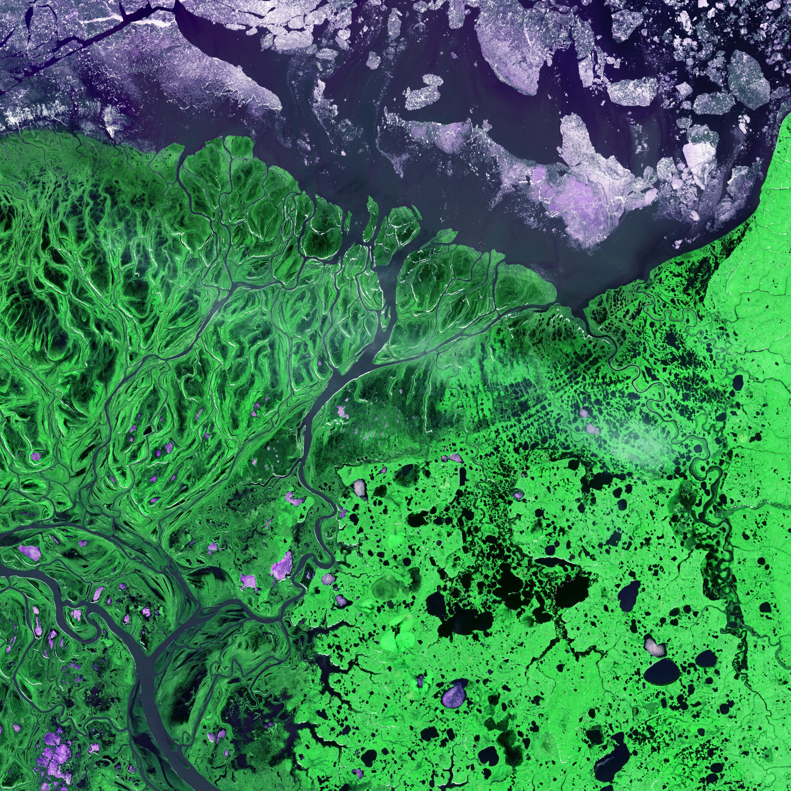
An intricate maze of small lakes and waterways define the Yukon Delta at the confluence of Alaska’s Yukon and Kuskokwim Rivers with the frigid Bering Sea. Wildlife abounds on the delta and offshore where sheets of sea ice form during the coldest months of the year. (© USGS)
The modern Yukon Delta is relatively young – just a few thousand years old. And things may change soon: because of the role of permafrost and ice in shaping deltas located in the Arctic, they are thought to be particularly vulnerable to climate change.
NIGER RIVER, MALI
Coursing through parched, landlocked Mali in Western Africa, the Niger River flows north through an ancient sand sea before turning sharply east to skirt the edge of the dune-striped Sahara. At the confluence of the Bani and Niger Rivers is an island delta complete with narrows, twisting waterways, lagoons, and tiny islands. (© USGS)
The swamps, lakes, and channels of the delta provide vital habitat for migratory Palearctic birds and West African manatees. The delta is also an essential resource for Malians, supporting livelihoods in fishing, farming, and pastoralism in an otherwise arid country.
MISSISSIPPI DELTA, USA
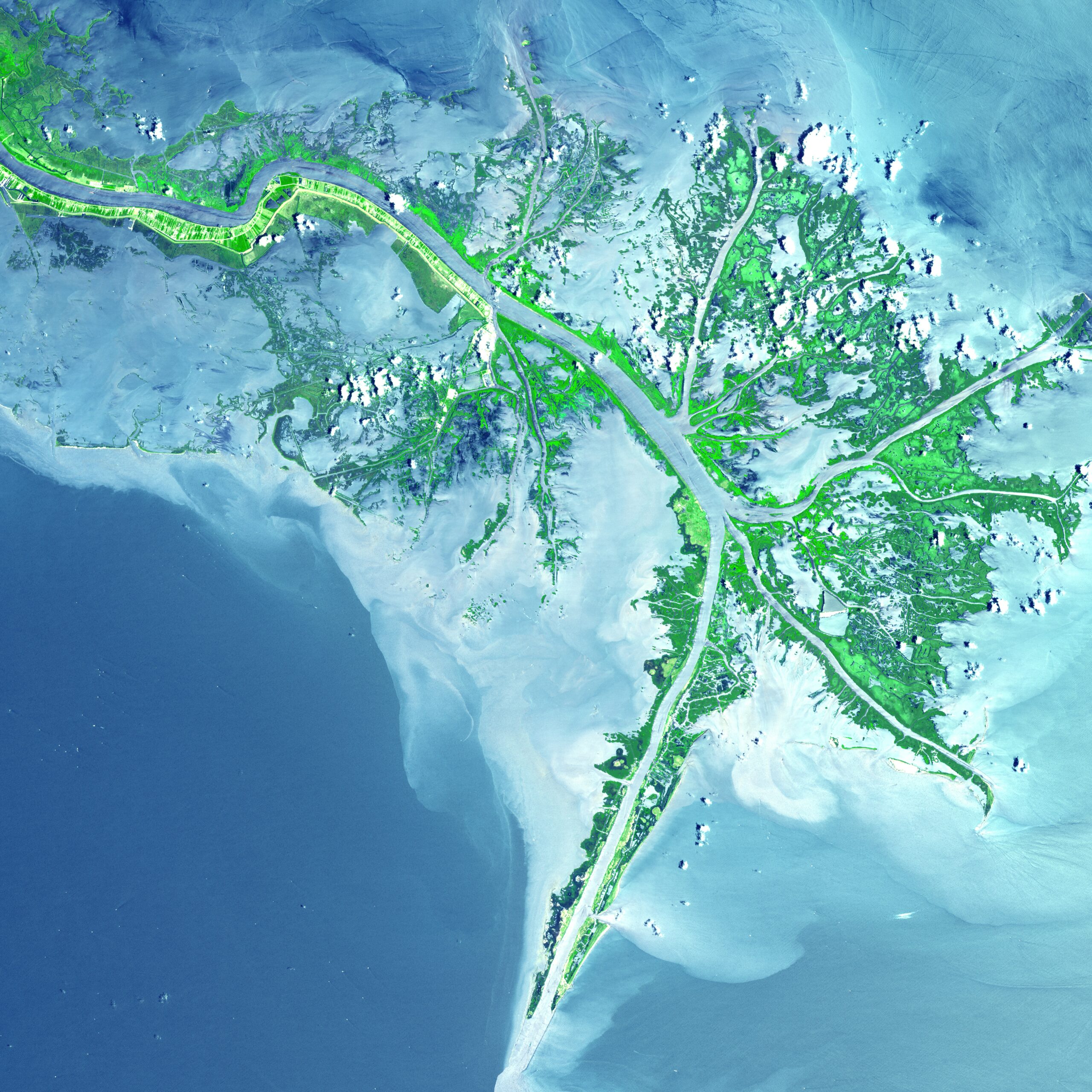
Turbid waters spill out into the Gulf of Mexico where their suspended sediment is deposited to form the Mississippi River Delta. Like the webbing on a duck’s foot, marshes and mudflats prevail between the shipping channels that have been cut into the delta. (© USGS)
The value of this delta has been estimated up to $1.3 trillion, reflecting its importance for fresh water, highly nutritious food, storm protection, vital natural habitats, tourism and shipping.
THE LENA RIVER DELTA, RUSSIA
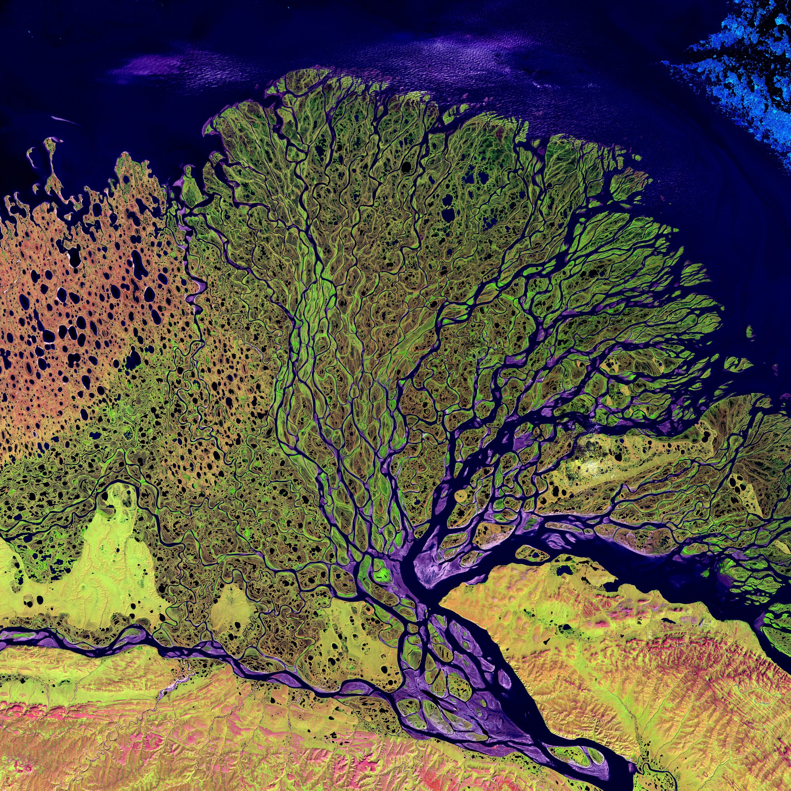
The Lena River, some 2,800 miles(4,500km) long, is one of the largest rivers in the world. The Lena Delta Reserve is the most extensive protected wilderness area in Russia. It is an important refuge and breeding grounds for many species of Siberian wildlife. (© USGS)
The river is of vital economic importance for the region, supporting livestock and crops including barley, potatoes and wheat. Large deposits of coal, natural gas and even diamonds have brought further prosperity, and the river also has an estimated hydroelectric potential of up to 40 million kilowatts.
MILFORD LAKE, USA
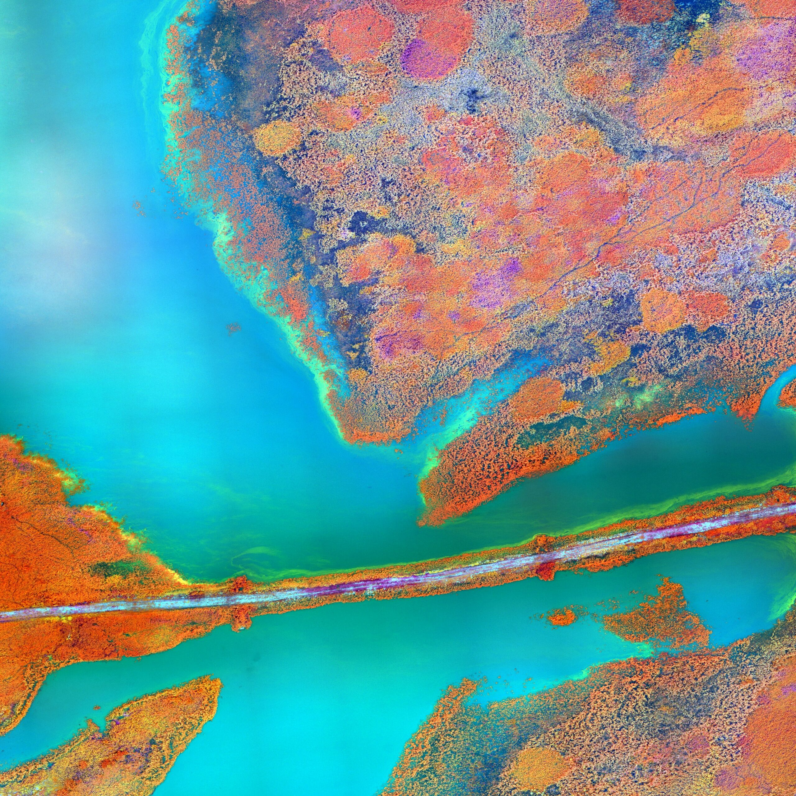
Milford Lake is a large man-made lake in Kansas, USA, which provides drinking water for ⅓ of the state’s population and plays an important role in flood control. As shown in this image, each year in the summer, algal blooms occur and can be harmful to the lake’s fragile wetland ecosystems (© USGS)
The USGS Kansas Water Science Center uses multispectral sensors on board drones to identify harmful algal blooms and study how they affect local businesses and human and animal health.
CHAUNSKAYA BAY, RUSSIA
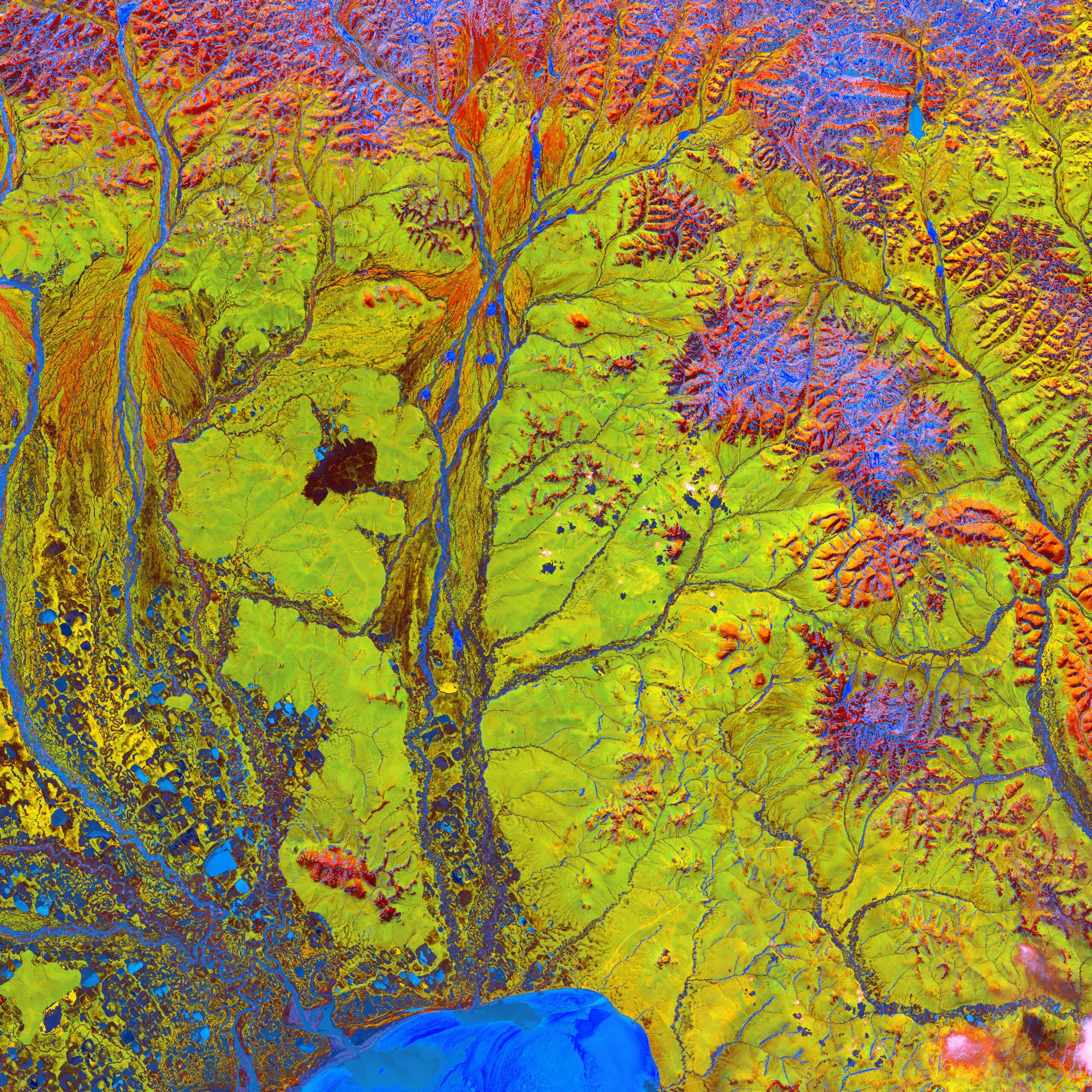
Vivid colors and bizarre shapes come together in an image that could be an imaginative illustration for a fantasy story. This labyrinth of exotic features is present along the edge of Russia’s Chaunskaya Bay (vivid blue half circle) in northeastern Siberia.
Two major rivers, the Chaun and Palyavaam, flow into the bay, which in turn opens into the Arctic Ocean. Ribbon lakes and bogs are present throughout the area, created by depressions left by receding glaciers. (© USGS)
